The Cổ Loa Citadel, functioning as Imperial Citadel, Military Citadel and Urban Citadel,
is located in the middle of the plain area, the national centre, the transportation hub by water and land,
with a dense population and a prosperous economy. Its existence with the assertive
hallmark of the first era of the national construction and defence, serves as a base and premise
for the development of great tangible and intangible cultural values in the region of this ancient Imperial City.
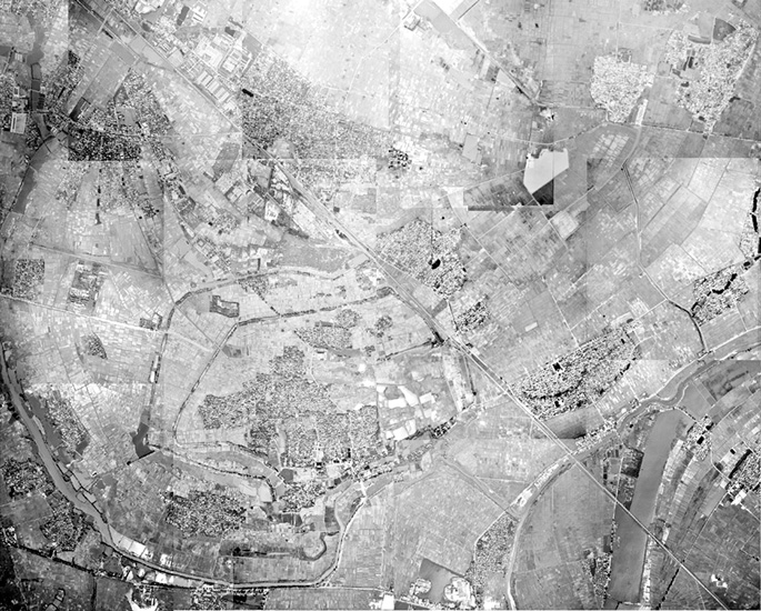
Satellite photo of Cổ Loa site
Source: Center for surveying and mapping data information
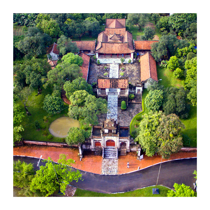
Thượng Temple

Bảo Sơn Pagoda
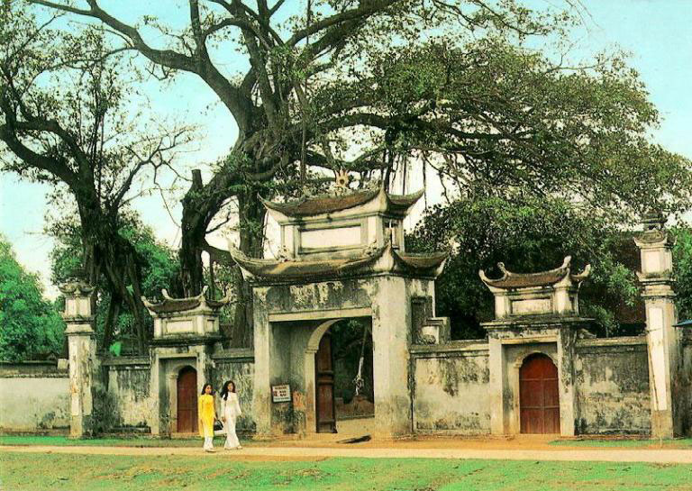
Ngự Triều Di Quy Communal House
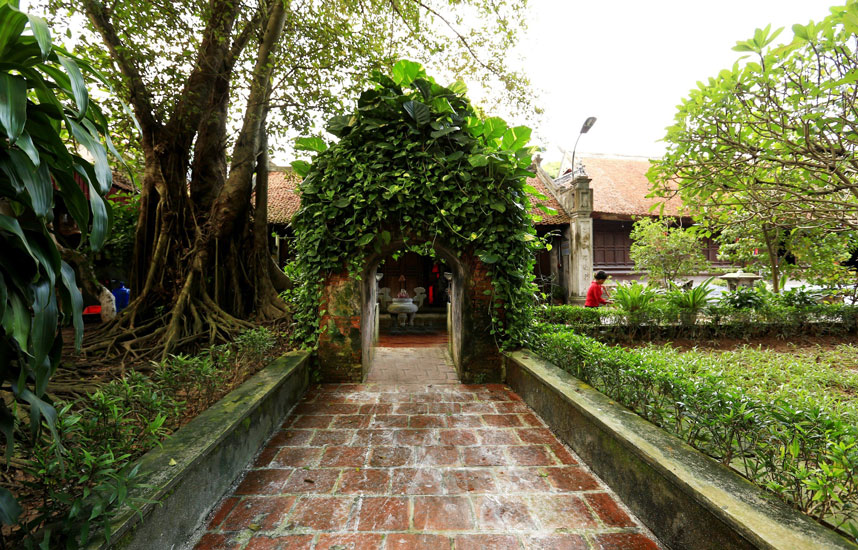
Mỵ Châu Temple

Cổ Loa Festival Space
In 1959, with the discovery of a warehouse of bronze arrows at Cầu Vực,
the extensive and large-scale archaeological research began in Cổ Loa and its vicinity.
The research on the citadel from the 1970s up to the recent years, especially in the 2007 - 2014
period has led to the identification and the profound knowledge of its scale, characteristics, structure,
functions, construction techniques.
Outline of important archaeological discoveries and excavations at the Cổ Loa citadel area
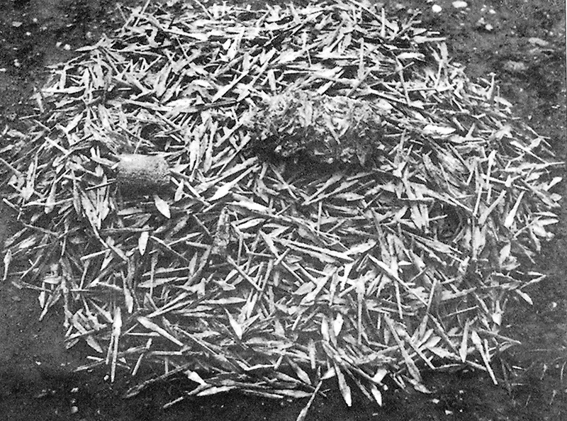
1959: Discovery of bronze arrows at Cầu Vực
1970: Excavation at the Outer Rampar at Mít village
1982: Discovery of Cổ Loa bronze drum and other bronze artifacts at Mả Tre
2004 - 2007: Excavation at the southwest corner of the Inner Rampart;
Discovery of a system of klns for making bronze arrows and javelins.
2007 – 2008: Excavation at a moat of the Middle Rampart
2012: Excavation at the Outer Rampart
2014: Excavation at the Bastion and the Inner Rampart
Archaeological excavation at the Inner Rampart in 2005 - 2007
The location where the sectional molds for making Cổ Loa bronze arrows.
Source: Lại Văn Tới
Sectional molds for making a swallow-shaped javelins - National treasure
Source: Management Board of Cổ Loa site area
Sectional molds for making three-sided bronze arrows - National treasure
Source: Management Board of Cổ Loa site area
Archaeological excavation of the Middle Rampart and its moat in 2007 - 2008
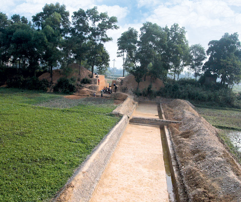
The plan of the excavated trench at the Middle Rampart and its moat
Mặt bằng địa tầng hố khai quật thành Trung
Nguồn: Trịnh Hoàng Hiệp
The cross-section of the eastern wall of the Middle Rampart moat
Source: Trịnh Hoàng Hiệp
Archaeological excavation at the Outer Rampart in 2012

Overview of the excavation at the Outer Rampart
The cross-section of the Outer Rampart in the northern view
Source: Trịnh Hoàng Hiệp
Archaeological excavation of the Inner Citadel and the Bastions in 2014
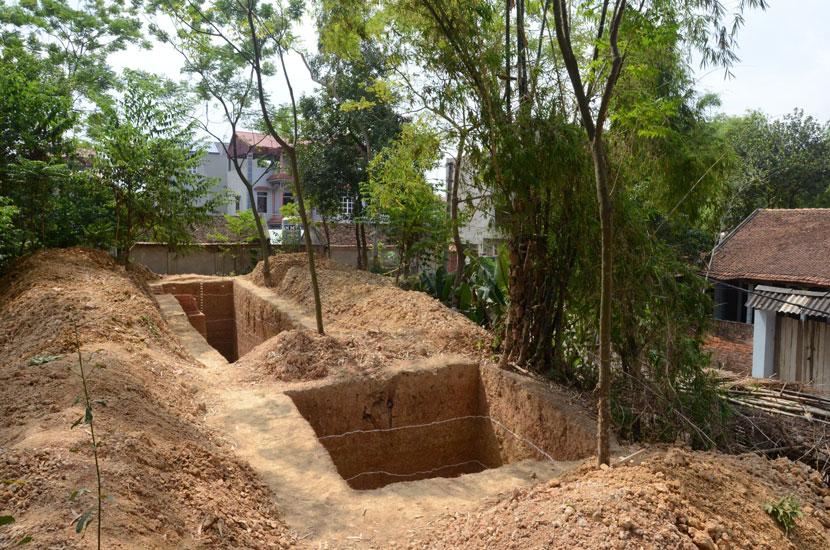
Overview of the excavated trench
Source: Trịnh Hoàng Hiệp
The scale, the construction structure of the Cổ Loa citadel
The Cổ Loa Citadel has a massive scale and structure, with three closed circular ramparts and its circumference is 16,000m.
The Inner Rampart is rectangular, the Central and Outer ramparts are closed curves that follow the natural land position.
The rampart outside is vertical, the inside is gently sloping. On the three ramparts, there are earth mounds called "Ụ Hỏa hồi" (bastions).
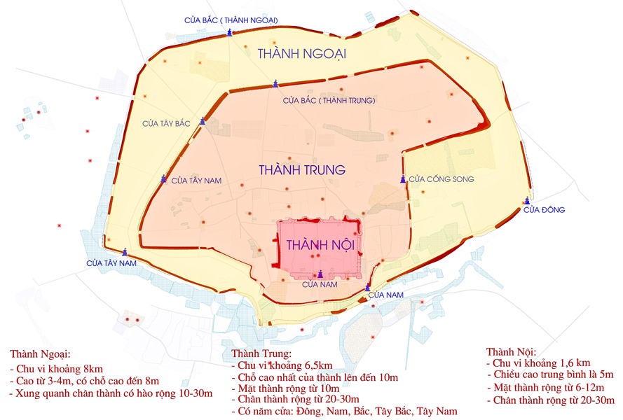
Map of Cổ Loa Citadel
Source: Dossier of Special National sites - Thăng Long - Hà Nội Heritage Conservation Center
The scale, the construction structure of the Cổ Loa citadel
The citadel ramparts all have gates, on which there are shines for worshipping the deities guarding them.
The Inner Rampart has 01 gate, the Middle Rampart has 05 gates, and the Outer Rampart has 04 gates;
The Central and Outer ramparts share a gate: Trấn Nam Môn.(Protecting southern gate)


Shrine of the Southern gate of the Central and Outer rampartss
Source: Nguyễn Văn Kự, 1988.
The scale, the construction structure of the Cổ Loa citadel
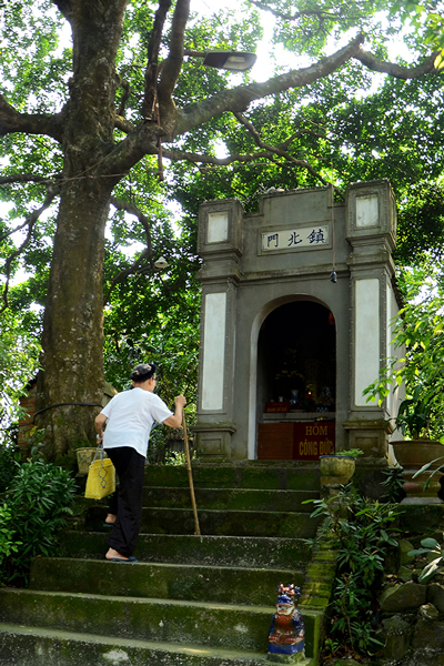
Shrine of the Northern gate
Source: Management Board of Cổ Loa site area
The scale, the construction structure of the Cổ Loa citadel
The 3 ramparts all have outer moats. Hoàng Giang River not only provides water and convenient transportation for the moats,
but also ensures the life and trade of the residents in the citadel. The system of the moats around the three ramparts turned
Cổ Loa into a strong military stronghold. At present, most of the moats has been landfilled, leaving some sections to remain.
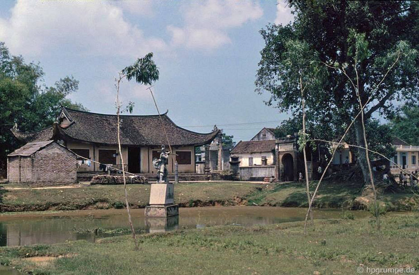

Lake/Pond in front of the Chùa, Chợ villages - traces of the ancient moats
Source: Hans-Peter Grumpe, 1991; Management Board of Cổ Loa site area
The scale, the construction structure of the Cổ Loa citadel
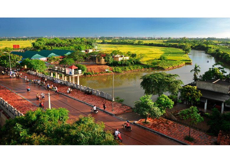
Hoàng Giang River in the Southeast view
Source: Management Board of Cổ Loa site area
The construction technique of the Cổ Loa citadel
When building the citadel, the King An Vương absolutely took advantage of the natural terrain of this area.
He connected the natural hills and mounds to form the ramparts, and at the same time cleared rivulets and
swamps to form moats. The higher the rampart were, the deeper the moats were.

East profile, excavation of the Outer Wall 2012
Draw by: Nguyễn Đăng Cường
The construction technique of the Cổ Loa citadel

West profile, excavation of the Outer Wall 2012
Draw by: Nguyễn Đăng Cường
The construction date of the Cổ Loa citadel
With the current archaeological and ancient historical data sources, the Cổ Loa Citadel is considered the earliest
and largest of the citadels in Việt Nam and Southeast Asia, which was built by King An Dương in the third – second
century BC and continued to be raised in the following periods.
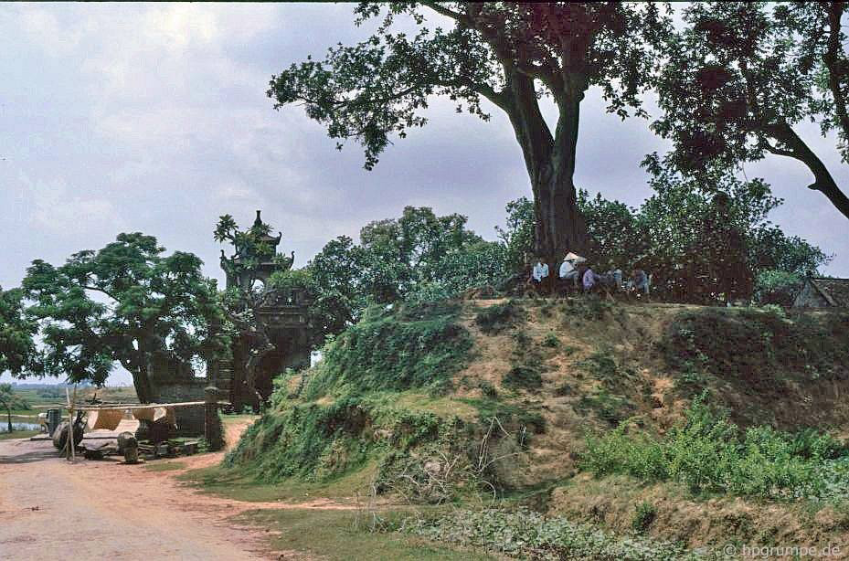
Southwest corner of the Inner Rampart
Source: Hans-Peter Grumpe, 1991.
The construction date of the Cổ Loa citadel
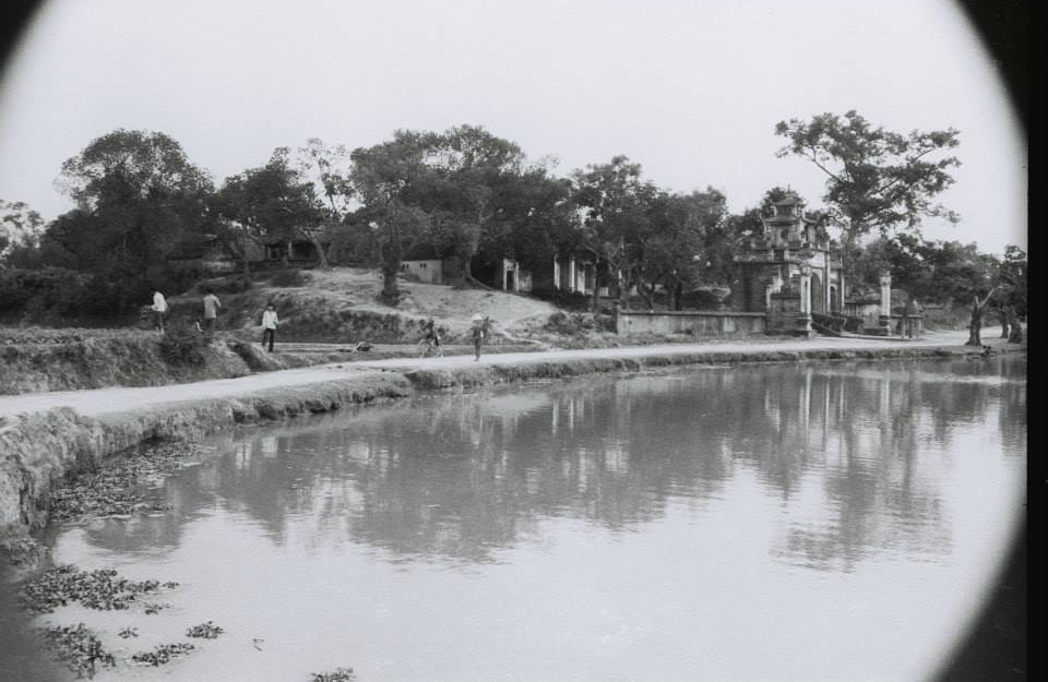
Remains of Cổ Loa Citadel in 1988
Source: Nguyễn Văn Kự
The construction date of the Cổ Loa citadel

The entrance to ancient Cổ Loa village
Source: Collected, 1913